Process of a typical search
How does it work ? My method
I use a rigorous method, which is based on technical and physical elements and on my gift for dowsing. Two types of interventions are necessary and complementary:
A) First intervention: the remote approach
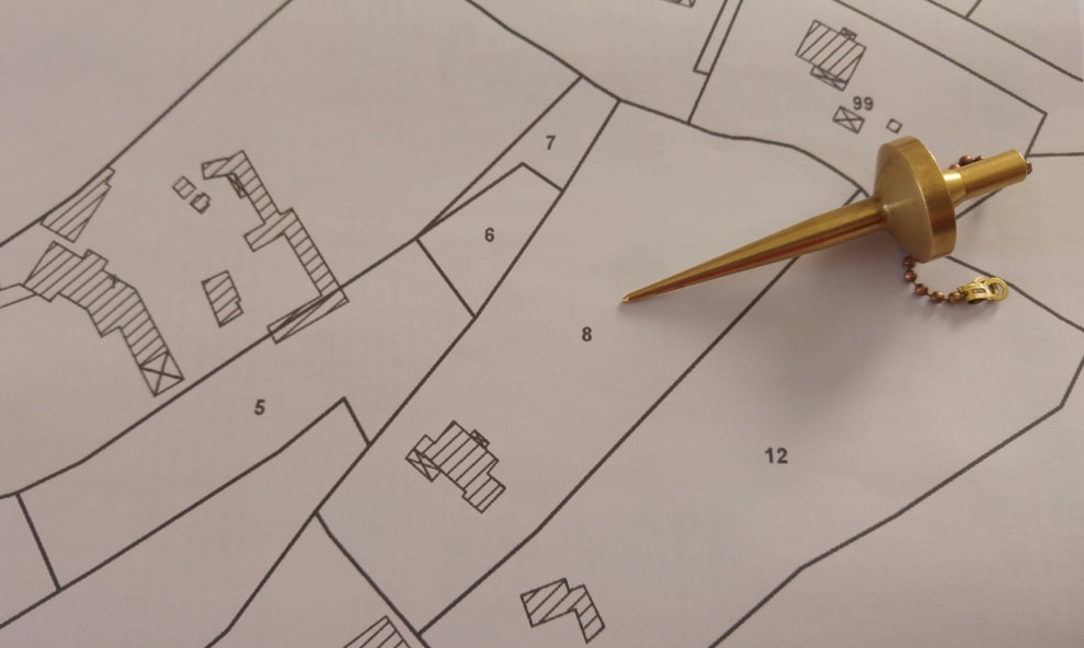
I work remotely based on the study of geological, hydrological, topological maps and other documents. This is my technical approach.
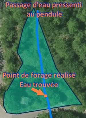
Then I trace, using the pendulum, an estimate of the passage(s) of water vein(s), if there is, because water is not present everywhere; contrary to an idea that has a hard tooth.
This also makes it possible to confirm whether or not there are water passages and avoid unnecessary expenses for the customer.
This may seem surprising, unreal, however some dowsers locate water passages from a distance on a cadastral map or aerial view. Which is my case too. The facts are there. But don't ask how it works, nobody knows! Assumptions and suppositions only.
This targeted and strict approach also makes it possible to confirm whether or not there are potential water flow and avoid unnecessary expenses for the customer.
I use a rigorous method, which is based on technical and physical elements and on my gift for dowsing. Two types of interventions are necessary and complementary:
A) First intervention: the remote approach
I work remotely based on the study of geological, hydrological, topological maps and other documents. This is my technical approach.
Then I trace, using the pendulum, an estimate of the passage(s) of water vein(s), if there is, because water is not present everywhere; contrary to an idea that has a hard tooth.
This also makes it possible to confirm whether or not there are water passages and avoid unnecessary expenses for the customer.
This may seem surprising, unreal, however some dowsers locate water passages from a distance on a cadastral map or aerial view. Which is my case too. The facts are there. But don't ask how it works, nobody knows! Assumptions and suppositions only.
This targeted and strict approach also makes it possible to confirm whether or not there are potential water flow and avoid unnecessary expenses for the customer.
|
My tools are my MH pendulum and my talent
|
The advantage of this method? Go to the essentials on the day of prospecting, directly on the estimated passage of the water vein.
Understanding and interpreting topology and geology maps is a major element for today's dowser. This allows me to realize dips, aquifer basins, geological accidents and many other points contained in these maps. This study is important because it allows you to know what to expect topologically and geologically when arriving at the scene. This is a step that I never neglect.
Understanding and interpreting topology and geology maps is a major element for today's dowser. This allows me to realize dips, aquifer basins, geological accidents and many other points contained in these maps. This study is important because it allows you to know what to expect topologically and geologically when arriving at the scene. This is a step that I never neglect.
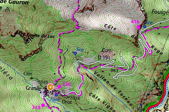
topology map
|
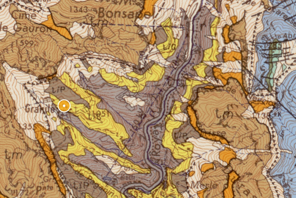
Geological map
|
B) Second intervention: land research
From my remote search, I move around the property with rods and a pendulum. According to my feelings, I trace on the ground the passages of water veins. And I specify well "my" felt, because rod and pendulum do not move alone and have no "power".
It is the dowser, who, by tiny and involuntary muscular contractions of his muscles, triggers the movement of the instruments.
The video below illustrates this point well.
C) Last stage of research:
I give an estimate of the flow and the depth of each vein detected. It's a feeling quite close to reality (see my various interventions on FB); and I emphasize that this is an estimate. Sometimes the water can be deeper, and there, it is the geology that decides. It is impossible today to have precision to the nearest meter, or to the nearest litre! Let's be realistic. I advise on the choice of this or that vein. Then I submit a prospecting report to the client and to one of the drilling companies with whom I work in confidence.
I give an estimate of the flow and the depth of each vein detected. It's a feeling quite close to reality (see my various interventions on FB); and I emphasize that this is an estimate. Sometimes the water can be deeper, and there, it is the geology that decides. It is impossible today to have precision to the nearest meter, or to the nearest litre! Let's be realistic. I advise on the choice of this or that vein. Then I submit a prospecting report to the client and to one of the drilling companies with whom I work in confidence.

Photo by Yånnīs Sklåvøs-Ålīx
Some explanations, hypotheses and clarifications.
Dowsers have physiological characteristics that make them sensitive to differences in electromagnetic fields.
Water is a very good electrical conductor; passing through underground faults, it flows over rocks or certain crystals, and generates minor disturbances of electromagnetic fields by friction. It is the electro-filtration of basements, a geophysical phenomenon.
The dowser "detects" these differences in magnetic fields.
Various scientific studies support these facts. And it is this hypothesis that I decided to retain in my understanding of the "dowsing signal" in the field. But it cannot, on its own, explain the totality of the dowsing feeling; especially for deep springs, or, at the start of the search when I do an "overview" of the terrain to determine the direction of travel, and even less the search on a map!
Note that in southern France, it is common to drill between 70 and 300 m deep. The dowser then accesses, perhaps unconsciously, vibrational information transmitted by the water to detect it so far from the surface or simply on the plane.
It should also be noted that whatever the depth, the rods or pendulum instrument reacts in the same way; more exactly, the body of the dowser, reacts in an identical way.
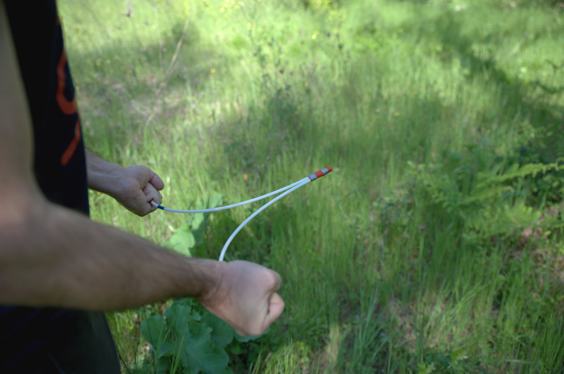
Photo by Carella AlexFoto
